

Industry

All tags

Netflix is exploring Gaussian splats as a future streaming format, Lowpass reports

BlogIndustry

In his Lowpass newsletter of 19 November, Janko Roettgers looks at how Netflix, ILM and others in Hollywood are adopting 3D and 4D Gaussian splatting. He points to a recent Netflix job listing that says the company is investigating Gaussian splats “as a future streaming format” for “consumer devices such as TVs, streaming sticks, phones, and laptops”.

The role is a 24-week paid internship, so the streaming work appears to be at an early stage. The intern is asked to “design and implement a proof-of-concept” of splat-based rendering on content of interest, with “a focus on building towards a practical system”. Roettgers notes that Netflix’s use of splats in production, through its Eyeline visual effects studio, is much further along, and that native splat support arriving in Blender and Unreal Engine this month could speed up adoption across film, TV and music video work.
ArcGIS XR Viewer beta adds initial support for Gaussian splat layers

BlogIndustry

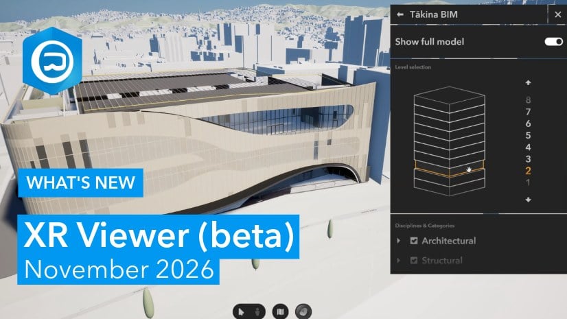
Esri’s November 2026 update of XR Viewer (beta), which turns ArcGIS 3D web scenes into experiences for VR headsets and desktop, lets users explore Gaussian splat layers, which the team calls “a frequently requested type of captured 3D content”. Esri describes it as initial support with limited functionality and known visual and performance limitations, with improvements planned.

The same release adds 3D point layers, a voice-driven XR Viewer assistant, a building explorer for BIM layers and a VR sketch tool whose drawings sync between participants in group meetups. It follows Esri’s general availability of ArcGIS Reality Server, which generates splats from drone imagery on customers’ own servers.

Get3D Mapper 7.1.11 straightens building outlines in orthophotos made from Gaussian splats

BlogIndustry

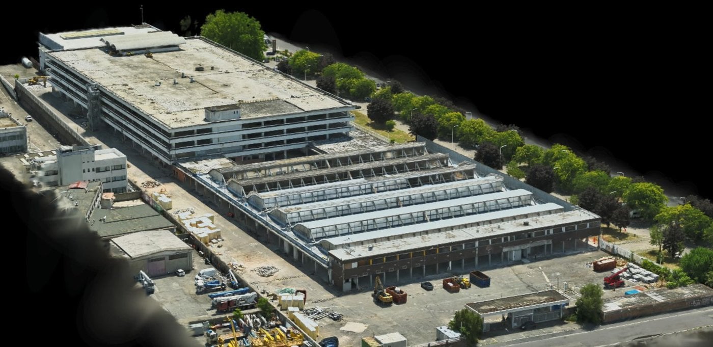
Get3D has released Get3D Mapper v7.1.11, reports Radiance Fields. The photogrammetry suite can generate a “3DGS-Enhanced DOM”, a digital orthophoto map rendered from dense Gaussian splats instead of projecting imagery onto a mesh, which Get3D says avoids leaning building outlines, occlusion artifacts and smeared vegetation. The new version makes building boundaries in these orthophotos straighter and corners more regular.

The release also adds in-app updates and downloads for Get3D’s Gaussian splatting plugin. Get3D cites a 265 km² urban mapping project in India delivered as a 3DGS-Enhanced DOM, and Mapper needs an NVIDIA GPU with at least 8 GB of VRAM. Get3D offers a 30-day trial from its downloads page.

Spotnik Technologies shows its browser-based national digital twin of the UAE

LinkedInShowcasesIndustry

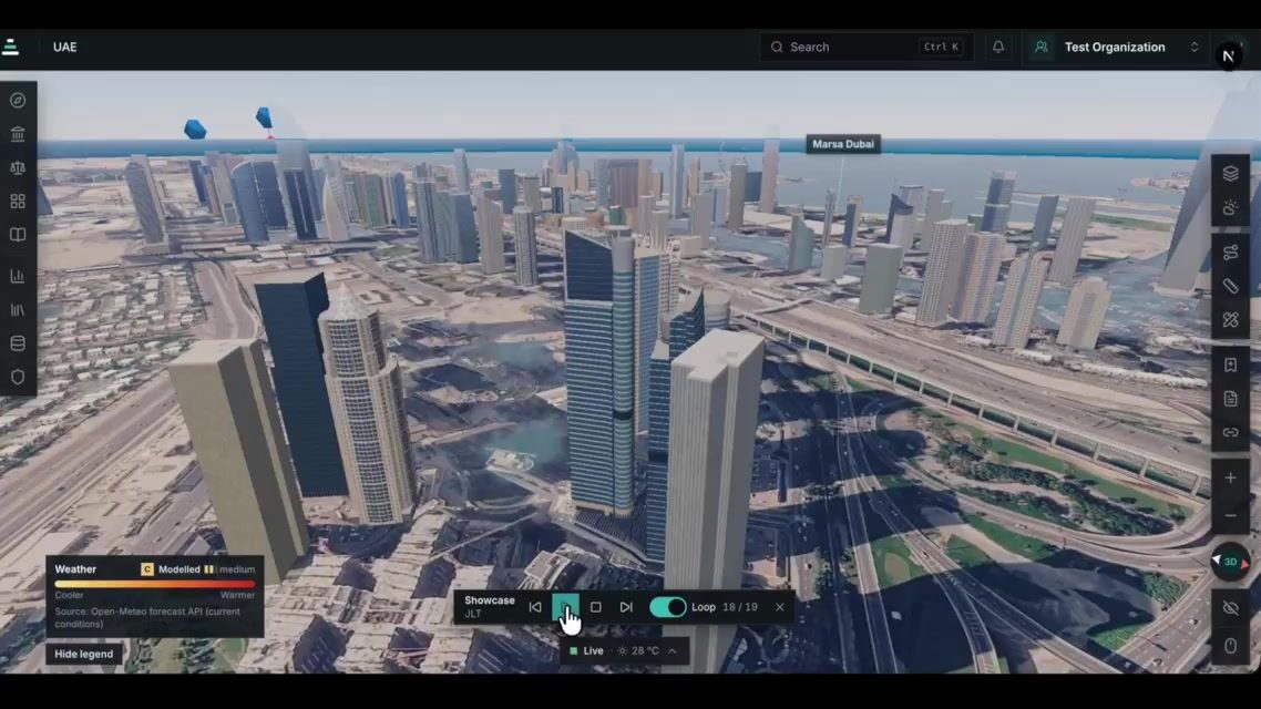
UAE-based Spotnik Technologies marked GIS Day on 19 November with a LinkedIn post saying its team is building a national digital twin of the UAE: “one shared 3D view of the country’s infrastructure, with the data that matters placed directly on it.” The company argues that national decisions on infrastructure, housing, mobility and sustainability depend on location data that usually sits in disconnected systems and reaches decision-makers as static reports.

According to the post, traffic, air quality, sensor readings and community indicators appear on the same view, so leadership, planners and technical teams work from the same facts. The twin runs in a web browser with no specialist software to install, every figure shows its source, and customers keep control of their own data. The attached three-minute video, described as “a short look at where we are today”, flies across the emirates, from Fujairah to Dubai Marina, with layers for weather, construction sites, intercity bus routes, public transport stops, hospitals, neighbourhood liveability scores and a landmarks list that includes power plants. The post does not mention Gaussian splatting or say how the 3D city models were captured.

Esri makes ArcGIS Reality Server generally available, with Gaussian splats

BlogIndustryCode & Tools

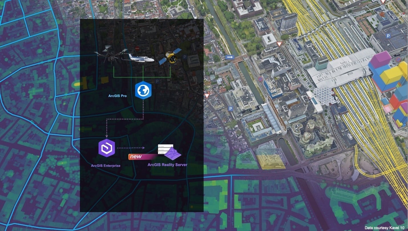
Esri has made ArcGIS Reality Server generally available with ArcGIS Enterprise 12.2. It is a self-hosted server role that processes large collections of drone, aerial and satellite imagery inside an organisation’s own GIS, on premises or in Microsoft Azure, and turns them into true orthos, elevation models, point clouds, 3D meshes and Gaussian splats. Reality Server was a beta feature in Enterprise 12.0 and 12.1.

According to the documentation, work is organised into projects for one location and missions for each capture session, and processing is distributed across several server machines, so large projects or several missions can run at once. Splats have their own hardware floor: every machine on the site needs at least 64 GB of RAM, an NVIDIA GPU with at least 8 GB of VRAM and compute capability 7.5 or higher, CUDA 13 or later and the Deep Learning Libraries.

Radiance Fields notes that projects are authored in ArcGIS Reality Pro or automated through the ArcGIS API for Python and the REST API, while the ArcGIS Reality Web App is still in beta, and that Esri lists no pricing. On the viewing side, ArcGIS Enterprise 12.2 lets Scene Viewer slice through Gaussian splats, check line of sight and extract elevation profiles in the browser.

XGRIDS puts the Lixel L3 on drones and cars, shipping in December

LinkedInHardwareIndustry

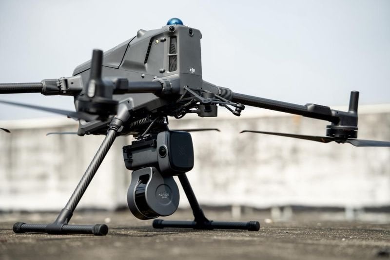
XGRIDS has announced dedicated drone and vehicle mounts for its Lixel L3 spatial scanner. In a LinkedIn post on 17 November 2026, also shared on X, the company says both setups let the scanner capture point clouds continuously while it moves, to cover large, complex sites and cut field time. Shipping begins in December through local XGRIDS distributors.

The drone-mounted solution is meant for aerial scanning of large sites, rooftops and building facades, with less risk for field crews. XGRIDS says the mounting angle is optimised for dense point clouds, the camera orientation for finely detailed colouring, and that scans are managed directly from the drone’s remote controller. The vehicle-mounted solution keeps point clouds uniform at 40 km/h, has an adjustable tilt for the scanner angle, and monitors the suction mount in real time while driving.

On its specification page, XGRIDS lists the L3 with 16 or 32 LiDAR channels, up to 640,000 points per second, a 0.7 to 120 m range, a forward camera and two panoramic cameras at 4096 × 3072, built-in survey-grade RTK and a 5 mm post-processed relative accuracy. Among the outputs are LCC (3DGS) single-scene reconstruction and 3DGS export as .lcc2, .lcc and .ply, next to point clouds, meshes, 3D Tiles and USD. XGRIDS says downloadable sample datasets and point cloud videos from both setups will follow, and that questions under the post will be answered in an upcoming FAQ. The LinkedIn post had 89 reactions when we picked it up.

Volinga joins Arquimea AI and stops selling licences on 1 December

BlogIndustry

Volinga, maker of the Volinga Suite splat editor and a Gaussian splatting plugin for Unreal Engine, is folding its technology into Arquimea AI. In a blog post, CEO Fernando Rivas Manzaneque writes that Volinga will sell licences for Volinga Plugin and Volinga Suite only until 1 December 2026. After that, subscriptions will not be renewed, the service will be wound down step by step, and no further releases of either product are planned.

Volinga was founded in 2023 as a spin-off from the Arquimea Research Center. Rivas Manzaneque writes that the media and entertainment market grew more slowly than expected, while technological sovereignty and security became more important and 3D Gaussian splatting began to spread into new industries. After a joint strategic review, Arquimea Group decided to move Volinga’s capabilities into Arquimea AI, its division for real-time AI in unmanned autonomous systems for mission-critical environments. There, the capture and neural rendering work is to be applied to safer agents and next-generation simulation systems.

Radiance Fields summarises the details from Volinga’s FAQ: on 1 December, new licences, extra seats, renewals, free trials and new accounts all end, while quotations accepted before that date can still be processed. Existing licences stay valid under their current terms, with basic email support until each subscription expires or until 1 December 2027, whichever comes first. Assets made under a valid licence remain the user’s, and Volinga asks customers to keep local copies of their files and exports. NVOL files created with an active Suite licence stay watermark-free, but rendering 3DGS models in Unreal without a watermark still needs an active Plugin licence.

CARLA 1.0 turns recorded drives into splat scenes with NVIDIA NuRec

GitHubCode & ToolsIndustry

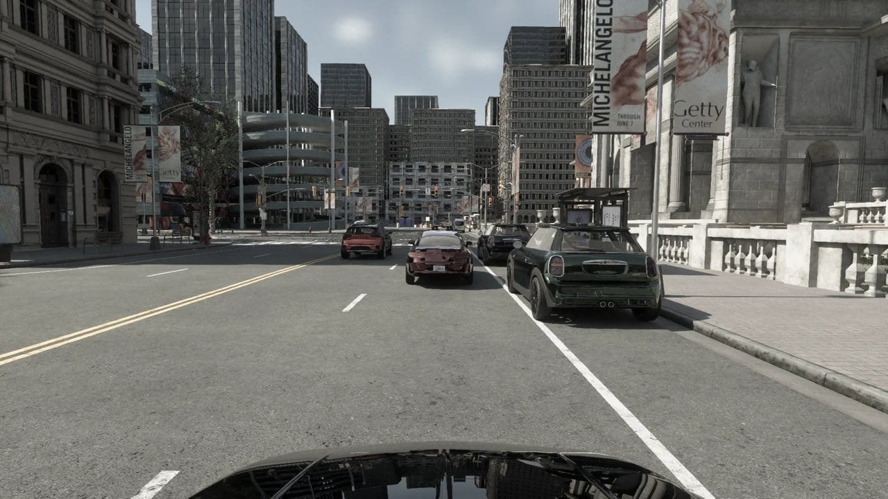
The open-source driving simulator CARLA has reached version 1.0 (17 November 2026), and one of its main features is support for NVIDIA NuRec 26.04, NVIDIA’s Gaussian splatting based neural reconstruction stack. A recorded real-world drive becomes a scene CARLA can simulate: CARLA owns the physics and the clock, and the NuRec renderer produces photoreal camera frames and lidar sweeps of the reconstructed scene. The release blog post calls it the most important release in the history of the project.

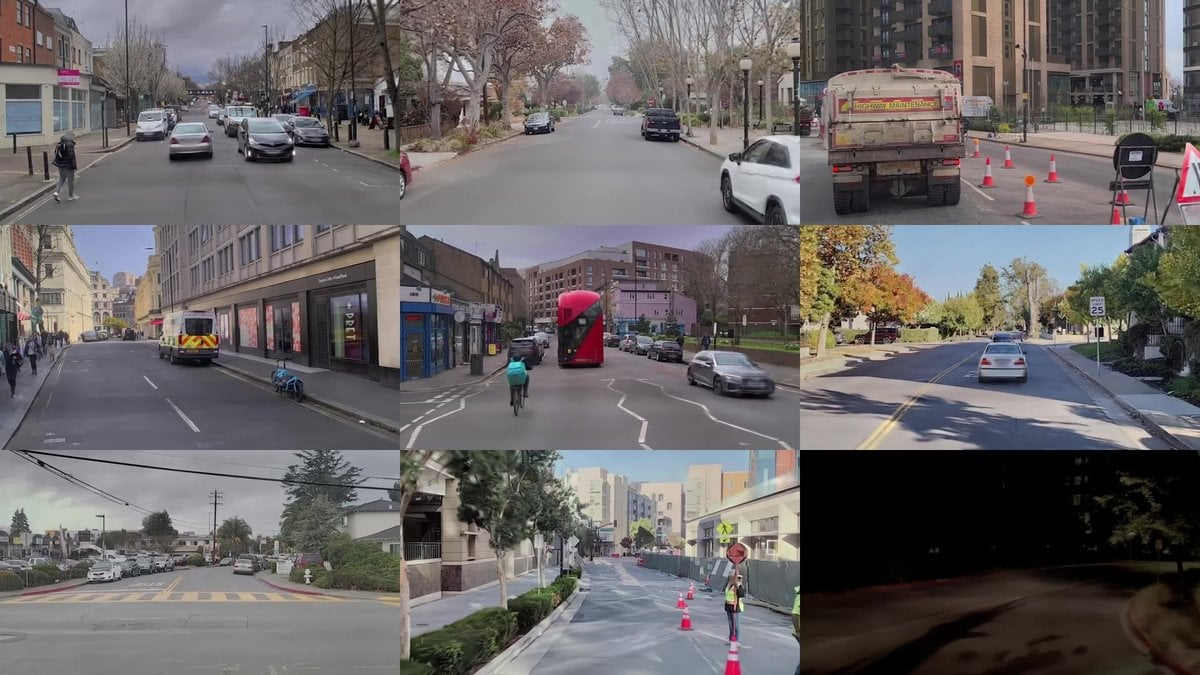
As Radiance Fields explains, a NuRec scenario is a .usdz file with the trained neural scene, the recorded actor tracks and the OpenDRIVE road network. The Neural Reconstruction Engine runs in a container and serves frames over gRPC, rendering all cameras due in one tick in a single batched round trip; the nrend or gsplat backend can be forced in the demo configuration, and the neural lidar models a PANDAR128 or an AT128. After a handoff, the ego vehicle can follow the recorded track, re-drive it with CARLA physics or drive freely under the Traffic Manager. Asset editing swaps the rendered asset of one vehicle or inserts a clone on a shifted trajectory, and a hybrid example composites CARLA vehicles and pedestrians into the neural scene, lit from the recorded environment and occluded correctly against the reconstruction.

CARLA 1.0 also moves from Unreal Engine 5.5 to 5.8 on CARLA’s own engine fork, adds NVIDIA Cosmos and DLSS 4.5, new ray-traced lens cameras and calibrated camera profiles, and ships for Ubuntu 22.04 and 24.04, Windows 11 and Docker. The Unreal Engine 4.26 line, where NuRec support first appeared in 0.9.16, is now obsolete. Sample scenes come from NVIDIA’s gated PhysicalAI-Autonomous-Vehicles-NuRec dataset on Hugging Face.

Lutra Consulting and North Road crowdfund Gaussian splats for QGIS 3D

BlogIndustry

Lutra Consulting and North Road have opened a crowdfunding campaign, QGIS 3D: Reality Capture, Animation and More, to bring 3D Gaussian splatting into the open-source GIS QGIS. The target is 85,000 euros, and the campaign ends on 7 December 2026. At the time of writing, 5,600 euros had been pledged.

The splat support would build on the tiled scene layers that the two companies added to QGIS in 2023, which today read 3D Tiles and Esri I3S scene layers with triangle meshes only. The plan is to parse 3DGS data encoded as 3D Tiles, using the KHR Gaussian splatting extension that came out of the joint standardisation work by Cesium, Esri and others, and to render it in both the 2D and 3D map views. Splat scans could then be overlaid with the rest of a project’s geospatial data. As a test, the team flew a DJI Mini 5 Pro over a small area, took 112 photos, and trained a scene of nearly 3 million splats with COLMAP and Brush, cropped in SuperSplat.

The campaign also covers a major upgrade to animation, atmospheric scattering that follows the time of day, scene presets for realistic or CAD and BIM display, fixes for the identify tool, and gamepad navigation. Pledges start at 200 euros and only become binding if the target is reached before the deadline. Work would then be delivered across the QGIS 4.6, 4.8 and 4.10 releases in 2027.

XGRIDS LCC Studio Universal V2.7.0 adds AMD and Intel GPU support

BlogCode & ToolsIndustry

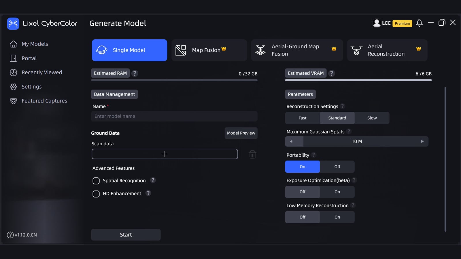
XGRIDS has released LCC Studio Universal V2.7.0, a Windows build of its local 3D Gaussian Splatting studio that runs on AMD, Intel, and other discrete GPUs. The package is listed on the official LCC Studio download page as a 5.5 GB installer dated 12 November 2026. It supports single-scene reconstruction, editing, and application.

The NVIDIA edition of V2.7.0 remains the recommended download. It shipped three days earlier, on 9 November, as a 5.8 GB build. Its release notes cover faster Map Fusion, Aerial-Ground Map Fusion, and HD Enhancement, sharper close-range reconstructions, fewer fragmented roofs in aerial work, a more stable editing architecture, and the option to export Map Fusion, Aerial-Ground Map Fusion, and Aerial Reconstruction results as USD and 3D Tiles. Reconstruction export and the Converter no longer support 3D Tiles v1. The Universal notes do not mention those fusion, aerial, or export features.

XGRIDS still lists an NVIDIA RTX 3060 12 GB as the official minimum GPU and an RTX 4090 as the recommended card. As of v1.9.0, Lixel L2 device data is no longer supported for reconstruction; the company points those projects to v1.8.1 or older.

XGRIDS brings a drone-mounted Lixel L3 to ElevateUAV 2026 in Miami

LinkedInEventsHardwareIndustry

XGRIDS will appear at ElevateUAV 2026 as a Bronze Sponsor, and says it is bringing a drone-mounted Lixel L3 reality capture setup to the show. The summit takes place on 17 and 18 November 2026 at Gulfstream Park in the Miami area. XGRIDS will be on the 3rd floor, in the Flamingo Room, at booth 18.

In a LinkedIn post, the company says the aerial setup is meant to cover large, complex sites faster and to reach places that are hard to access on foot. It will also show the Lixel K2 and the PortalCam, covering aerial and ground-based scanning for building and urban surveying, infrastructure, public safety and terrain mapping. Tickets are listed on the ElevateUAV site.

The Lixel L3 is XGRIDS’ flagship spatial scanner. The company says a single pass can produce a true-color point cloud, a mesh and a 3D Gaussian Splatting model, with a verified 5 mm relative accuracy. It combines LiDAR, a 1/1.3-inch CMOS 4K HDR camera, built-in RTK and a 4.3-inch display, so the scanner does not need a phone connection on site.

ON3D becomes XGRIDS partner for IsraelFeature

BlogIndustryHardware

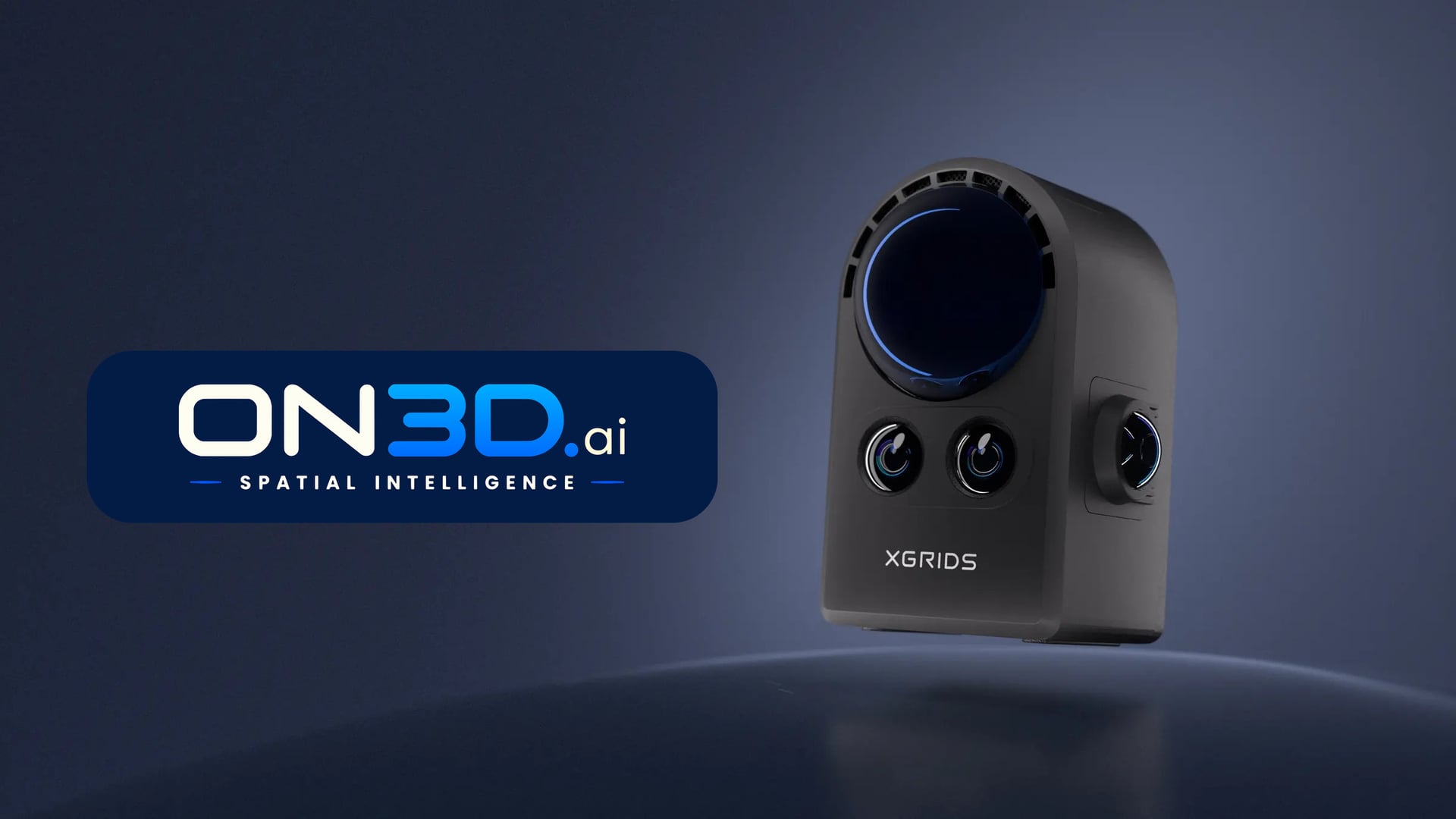
ON3D, a division of Exodus HUB created as a result of the #100Splats campaign, is now listed on XGRIDS’ official international agent page as a partner for Israel. The company sells and supports the PortalCam spatial camera and LCC Studio software locally. The joined forces of the Nakash family and Josua Hönger open promising business opportunities and are a big gain for the Gaussian splatting community.

XGRIDS names the Season One winners of the World Backup Project

LinkedInShowcasesIndustry

XGRIDS has announced the Season One winners of its World Backup Project, a call for 3D Gaussian Splatting creators to capture a piece of reality and take it further. The official campaign page says entries opened on 31 August 2026 and closed on 31 October, with winners due on 7 November and a featured showcase on 14 November. An entry had to include at least one XGRIDS tool in the workflow, such as the LCC Scan phone app, PortalCam or Lixel hardware, LCC software, or an SDK or plugin. It did not have to use only XGRIDS tools.

The grand prize is a PortalCam and automatic entry into the XGRIDS Signed Creator Program. It goes to Josette Seitz, for Burning Man and the Colosseum; Split View Studio, for the Monastery of Santa María de la Valldigna; and Studio Duckbill, for interactive 3D experiences across three waterways in Japan.

Second prize, a one-year LCC Studio Premium license, goes to Christoph Schindelar, Stephen Ryan, Billy Wong, Eli Jensen and Gabriele Romagnoli. Third prize, a six-month license, goes to Lukasz Mirocha, Aurélien Camart, Olivier Kerremans, LotXR and Josua Hönger. Fourth prize, a three-month license, goes to Paolo Tosolini, Desierto Florido, arlData, Alan Creek and Manuel Allinger. Fifth prize, a one-year LCC Cloud license, goes to Cutter Shea, Alex Vizitiu and Nicolas Brice.

The names and project titles above follow the XGRIDS LinkedIn announcement. Prize details follow the official campaign page.

World Labs opens Atlas to everyone, with tools that export Gaussian splats

BlogIndustry

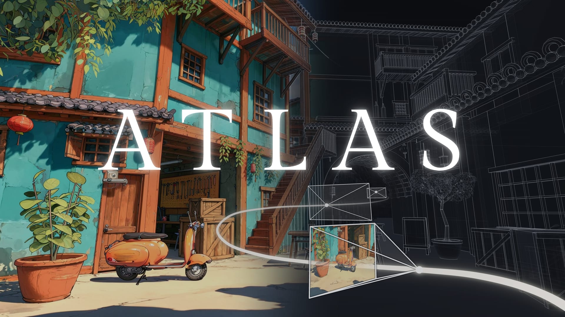
World Labs has opened access to Atlas, its next-generation world model, to everyone. In a 12 November 2026 LinkedIn post, the company wrote that it had built a suite of apps and API endpoints to help people build 3D worlds with Atlas, then export keyframes, video clips and 3D Gaussian splats.

The official Atlas page, listed on the World Labs blog on 12 November 2026 as “Atlas: Releasing our next generation world model,” describes four tools launching with the model, plus a developer API. Viewfinder reconstructs a scene from photos or generated images, explores new viewpoints and renders camera paths. Chisel shapes a world through controllable scene building and grayboxing, with every camera view updating as objects move. Splats to Mesh converts splats into meshes with real geometry for games and interactive environments, and Relight lights and manipulates splats. The developer API and integrations are meant to bring Atlas into other applications and existing tools, including Blender. World Labs first introduced Atlas on 1 September 2026 as an early-access world model for spatial intelligence.

3Dflow releases 3DF Zephyr 9.5, a stepping stone toward version 10.0

BlogCode & ToolsIndustry

3Dflow published 3DF Zephyr 9.5 on 11 November 2026, describing the release as “an important stepping stone towards version 10.0.” The update follows Zephyr 9.0, which added an integrated Gaussian Splatting workflow, also in Zephyr Lite.

The 9.500 changelog lists speed improvements to Structure from Motion and Multi-View Stereo, a more responsive LOD Mesh dialog with faster loading, and improved extraction quality for sections, level curves and guided breaklines. Volume-from-projection and hole-filling tools were revisited, a bug affecting GPS data after merging was fixed, frame extraction with the similarity threshold was made consistent, and exported videos were fixed for compatibility with Instagram and Facebook. The same changelog lists the release of 3DF Jimbo, a local segmentation-model trainer that produces models for classification in Zephyr or masking in 3DF Masquerade; 3Dflow says Jimbo is currently available to selected customers only.

ArcGIS Maps SDK for JavaScript 5.2 adds viewshed and shadow-cast analysis on Gaussian splat layers

BlogCode & ToolsIndustry

Esri’s 10 November 2026 announcement for ArcGIS Maps SDK for JavaScript 5.2 says version 5.2 adds Viewshed and Shadow Cast analysis for Gaussian Splat layers. The official post notes that splat layers already participated in scene shadows, and that this release extends analysis to those two tools.

Radiance Fields, citing Esri’s 5.2 release notes, reports that analysis results reflect the underlying splat representation: surface noise or reconstruction artifacts that are subtle in the visualization may become more apparent, and analysis boundaries may appear less sharply defined than comparable results from integrated mesh layers. The same Radiance Fields write-up says volume measurement is not named for splat layers in the 5.2 notes. The official blog also describes new tooltips and snapping when placing viewshed and line-of-sight observers and targets, including elevation-mode selection and simple math expressions such as +1.5.

GreenValley International names Land Axis Limited its official dealer in Kenya

LinkedInIndustryHardware

GreenValley International posted on 11 November that Land Axis Ltd has joined its partner network as official dealer in Kenya. The announcement describes a partnership to bring “advanced Spatial Intelligence solutions” to professionals in Kenya and the wider East African market, and to make a complete end-to-end LiDAR workflow more accessible to local customers, from data capture and processing to analysis and decision-making. The post itself does not mention Gaussian splatting.

Land Axis Limited’s public site, landaxisltd.com, lists the same contact number published in the announcement, +254 713 169 969, and describes the firm as a Kenyan land-surveying, geospatial and drone-technology company. GreenValley separately markets LiSplat for large-scale Gaussian scenes; that product is not named in the Kenya dealer post.

Manifold Tech will show its Odin Series at Swiss Robotics Day 2026

LinkedInEventsHardwareIndustry

Manifold Tech Limited posted on 12 November that it will exhibit its Odin Series Spatial Memory Modules at Swiss Robotics Day 2026 on 13 November, writing that the modules are meant to help robots perceive their surroundings, relocalize and navigate, and inviting developers to the booth. The company’s post lists the location as Lausanne, Switzerland, Booth 22.

The official Swiss Robotics Day 2026 site places the event at StageOne Event & Convention Center in Zurich on 13 November, and the exhibitor list names Manifold Tech at booth 23. We have not seen a correction from either side. Manifold’s Odin1 product page also lists MindCloud Render as Gaussian rendering software in the MindCloud suite; the LinkedIn post itself does not mention Gaussian splatting.

3Dflow's 3DF Zephyr 9.0 folds Gaussian Splatting into its photogrammetry pipeline

BlogCode & ToolsIndustry

3Dflow, the Verona software house behind 3DF Zephyr, added a Gaussian Splatting workflow in Zephyr 9.0, released on 14 July 2026. The feature is also available in 3DF Zephyr Lite. 3Dflow is a privately held computer-vision company, established in 2011 as a spin-off of the University of Verona and in 2012 of the University of Udine, with offices in Verona.

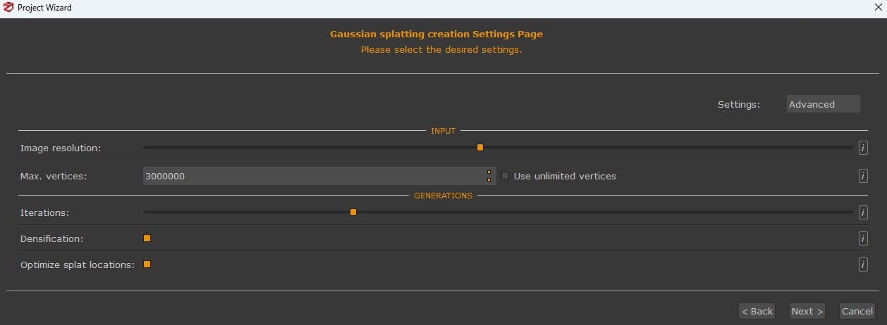
Zephyr’s documentation says splats are always generated from an existing structured point cloud in the workspace: the SfM sparse cloud, a dense cloud from Zephyr’s multi-view stereo, an external cloud such as a structured laserscan, or, for best results, a dense cloud refined by photoconsistency meshing. The result is a view-synthesis visualization, not a new geometric deliverable such as a mesh. Generation can be queued in the Project Wizard or started from Workflow > Advanced > Dense Point Cloud Generation. It runs on a single GPU only; CUDA cards perform best, OpenCL is slower, and CPU processing is strongly discouraged. Version 9.0 can also export Gaussian Splatting objects, and workspace merges now include them.

Flytech: the Italian engineers measuring the world from the air and now testing Gaussian splattingFeature

LinkedInIndustryHardware

Flytech is a young Italian engineering firm that turns drone, LiDAR and thermal data into certified, measurable results. Founded by civil engineer Davide Giovinazzo, it surveys sites to centimetre accuracy, inspects solar plants and is now testing DJI Terra's new Gaussian Splatting features.

Niantic Spatial's object-interaction beta lets you move objects inside a Gaussian splat

BlogIndustryCode & Tools

Niantic Spatial has launched object interaction, a beta that makes individual objects in a captured Gaussian splat environment selectable and movable in simulation, Radiance Fields reported on 10 November 2026. The feature separates whole objects from the surrounding splat, keeps each object’s appearance, and attaches collision information plus simplified, estimated physical properties. Those properties are a baseline for how objects interact, not a replacement for detailed physics simulation.

The workflow identifies candidate objects, extracts and cleans them, then represents each one so it can be selected, moved or removed to produce a different layout. Niantic Spatial built it for robotics teams whose robots work in places that change after capture, so a policy can be tested across varied layouts of the same recognizable environment. The tool joins splat relighting, introduced in September, which recomputes per-Gaussian spherical harmonics against an aligned mesh so collision and navigation meshes carry over. Used together, the two features vary layout and lighting in one captured environment without rebuilding it. Customers on the Deploy and Enterprise Embodied AI plans can pilot the beta on up to 10 scenes.

XGRIDS publishes LCC2 captures from LCC Studio into District Cinema Terra

LinkedInIndustryHardware

XGRIDS posted that 3D Gaussian splat captures can be published from LCC Studio into District Cinema’s Terra platform, turning real-world locations into a 3D workplace for virtual scouting and production planning. LCC2 models can be published from LCC Studio to Terra in a few clicks. Once there, the post says teams can explore locations remotely, place 3D assets in their actual spatial context, and use real-world dimensions to plan camera setups, rigging, cable runs and equipment placement, with annotations and shared views for coordination across departments.

XGRIDS points to District Cinema Terra and its LCC Studio downloads for the two ends of that path. The company frames it as one capture serving both reality-capture and film-production workflows, from location scouting through technical planning.

Sasori Zero Labs shows live KIRI 3DGS assets inside Unity 6.3.2 and Ferrous

XIndustryCode & Tools

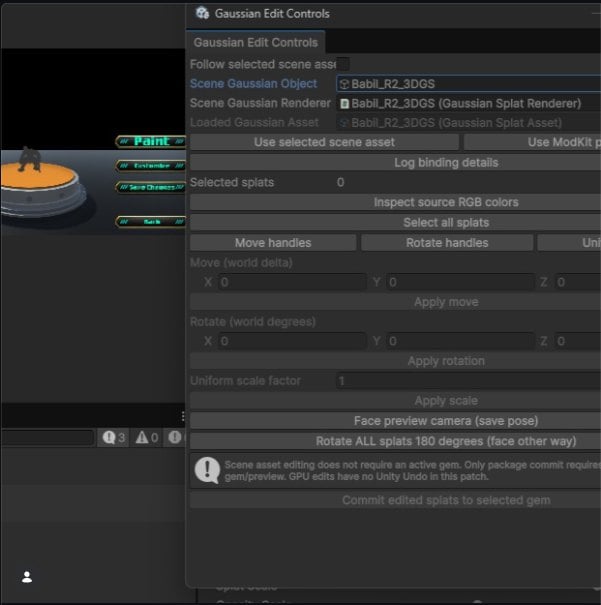
Sasori Zero Labs posted on 10 November that its KIRI Engine pipeline can now demonstrate live controls and real 3D Gaussian Splatting assets in Unity 6.3.2. The same post says Ferrous now accepts PLY files exported from a phone, with a feature for transferring those exported PLY files directly into Ferrous Modkit.

The announcement is a public post with an accompanying screenshot; it does not include a standalone product page or versioned changelog beyond what the post itself states.

Tijerín Art Studio rebuilds Quick GS Editor on Spark and ships a Windows Pro edition

BlogCode & ToolsIndustry

Radiance Fields reports that Tijerín Art Studio has rebuilt its free browser editor, Quick Gaussian Splat Editor, on World Labs’ Spark renderer and has also released Quick GS Editor Pro, a paid Windows edition. The studio says the rebuilt editor renders over 100 million points across multiple 3DGS assets in one scene; the free edition still runs in the browser with no download.

The Pro build is a portable 191 MB Windows app that runs offline. It can install VAST’s TripoSplat locally for single-image splat generation (listed minimum: an NVIDIA GPU with 6 GB of VRAM and CUDA 12.1, plus a slower CPU fallback), adds an HDRI Reflect Engine for custom spherical harmonics, and includes an experimental particle fluid simulator that bakes to a timeline and exports sequential PLY frames. Neither listing gives a version number or source code; both carry an itch.io AI-assisted-code disclosure. Pro is listed at $8.99 or more on itch.io.

SpatialView indexes Gaussian splat scenes so AI agents can query them in language

BlogIndustryCode & Tools

Radiance Fields reports new work from Vancouver-based SpatialView on using radiance-field captures as a data source for AI agents. Rather than depending on the original survey photographs, the pipeline renders a compact set of virtual views from the finished Gaussian splat, embeds each view with an image-text model, and stores it with its camera position as a “scene matrix.”

A query such as “where is the fire extinguisher?” returns the best-matching rendered views and their locations in the 3D model. On a 1.8-million-Gaussian cabin scan with source photos withheld, SpatialView reports that 122 virtual photographs were enough to index the scene, compared with 362 photos in the original capture, with framing and embedding taking under two minutes. The write-up includes a browser demo of that cabin.

CHCNAV CoCloud adds a renderer that preloads 3DGS models of up to 5 GB

BlogIndustryCode & Tools

CHCNAV has updated CoCloud, its cloud processing platform, with a new rendering engine for 3D Gaussian splatting models. CoCloud already generated point clouds, orthophotos, 3D models and 3DGS results from uploaded field data; CHCNAV says the new engine preloads 3DGS models of up to 5 GB in seconds, but it does not state the splat counts, file formats or client hardware behind that figure, or whether 5 GB is a hard ceiling.

The company also credits expanded cloud capacity with making CoCloud data processing 20% faster, and it adds AI pedestrian filtering, point cloud denoising and real-time job progress tracking. CHCNAV has published no version number or release notes for the update, which it announced on LinkedIn.

Rivian acquires Third Dimension AI, whose SuperSim rebuilds drives with splats

BlogIndustry

Rivian announced on 22 October that it has acquired Third Dimension AI, the US startup behind SuperSim. Financial terms were not disclosed, the deal has closed, and Third Dimension’s leadership and technical staff join Rivian’s Autonomy research and engineering teams. James Philbin, Rivian’s SVP of Autonomy and AI, said simulation is central to how the company trains and validates its autonomous driving systems.

Rivian’s own release does not mention Gaussian splatting. Radiance Fields and TechCrunch note that SuperSim, introduced in December 2025, rebuilds recorded driving scenes from video, LiDAR, IMU and positional traces with neural rendering and Gaussian splatting, then uses world modeling to render novel views and insert objects that were never in the capture. Third Dimension was founded in 2024 and had raised a $7 million seed round, according to TechCrunch.

Clemson turns existing Memorial Stadium drone photos into a Gaussian splat

BlogShowcasesIndustry

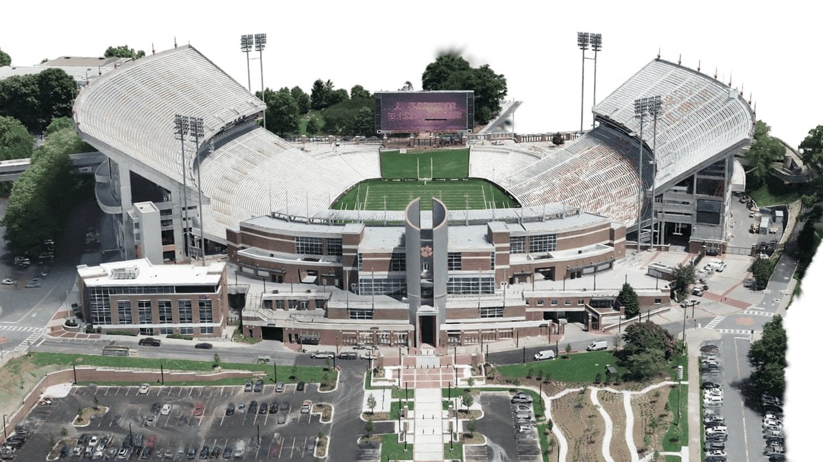
Clemson University’s Center for Geospatial Technologies reprocessed existing drone imagery of Memorial Stadium into a Gaussian splat and a mesh in Esri ArcGIS Drone2Map, with no new flights. Drone2Map added a Gaussian splat product in version 2025.2, generated as a 3D tile layer using deep learning, and Jared Gingrich ran the stadium imagery through the 3D Products template, which outputs point clouds, textured meshes and Gaussian splat layers from the same camera alignment; the stadium mesh and splat processed together in about 13 hours.

Esri does not state the hardware behind that run, the splat count, or the drone used for the original capture. According to Esri, the splat covers the stadium and surroundings as a single segment and loads much faster than a campus mesh that had to be split into 10 segments, resolving light poles, flagpoles, upper-tier spires, goalposts and tree branches that the mesh rendered poorly. The project is also detailed in Esri’s ArcWatch case study.

Hesai launches Kosmo, a lidar and 8K camera for Gaussian splat capture

BlogHardwareIndustry

Hesai has launched Kosmo, its first Gaussian splatting product, pairing the Kosmo One handheld capture device with the Kosmo World cloud platform that reconstructs captures as 3D Gaussian splats, meshes and depth. Kosmo One combines a Class 1, 1535 nm lidar rated at 569,000 points per second and 40 meters of range at 10 percent reflectivity with an 8K imaging system on a one-inch sensor and a high-precision IMU; Hesai claims millimeter-level geometric accuracy, says a typical 100 square meter room takes about 15 minutes to scan, and lists about 60 minutes of runtime from the standard battery.

Kosmo World produces aligned 3DGS, mesh and depth outputs from a single reconstruction and can fill missed areas with generative AI. Exports include .ply and .sog splats, .obj meshes, and .usd and .usdz scenes, with listed integrations for NVIDIA Isaac Sim, Isaac Lab, Unreal Engine, RenderMan and Houdini. Hesai has not published pricing or regional availability.