
Hardware

All tags

Splatara Cloud Renderer streams PC-rendered splats to up to four Quest headsets

BlogCode & ToolsHardware

Killian Cartelier, Eugene Yew and MakerFred have entered Splatara Cloud Renderer in the Meta VR Start Developer Competition 2026. Radiance Fields reports that a Windows PC with an NVIDIA RTX GPU renders the Gaussian splat scene per eye with a CUDA rasterizer, encodes it as HEVC with NVENC and streams it over Wi-Fi to Meta Quest headsets, which reproject each frame to the latest head pose. Multi-gigabyte captures are split into level of detail files, and one PC serves two headsets by default and up to four.

Sessions begin in passthrough, with a ring that opens onto the captured place. Environment depth and the room scan keep hands, other players or a dog in front of the splats, and headsets in the same room share a spatial anchor so everyone sees the scene in the same place. A PC scenario editor lays out scenes, portals, sounds and rules. The client runs on Unity 6 with URP and Vulkan on OpenXR, and download links are on the Devpost submission.
ASU open-sources Open4DGS for 4D splats from consumer cameras without genlock

BlogCode & ToolsHardware

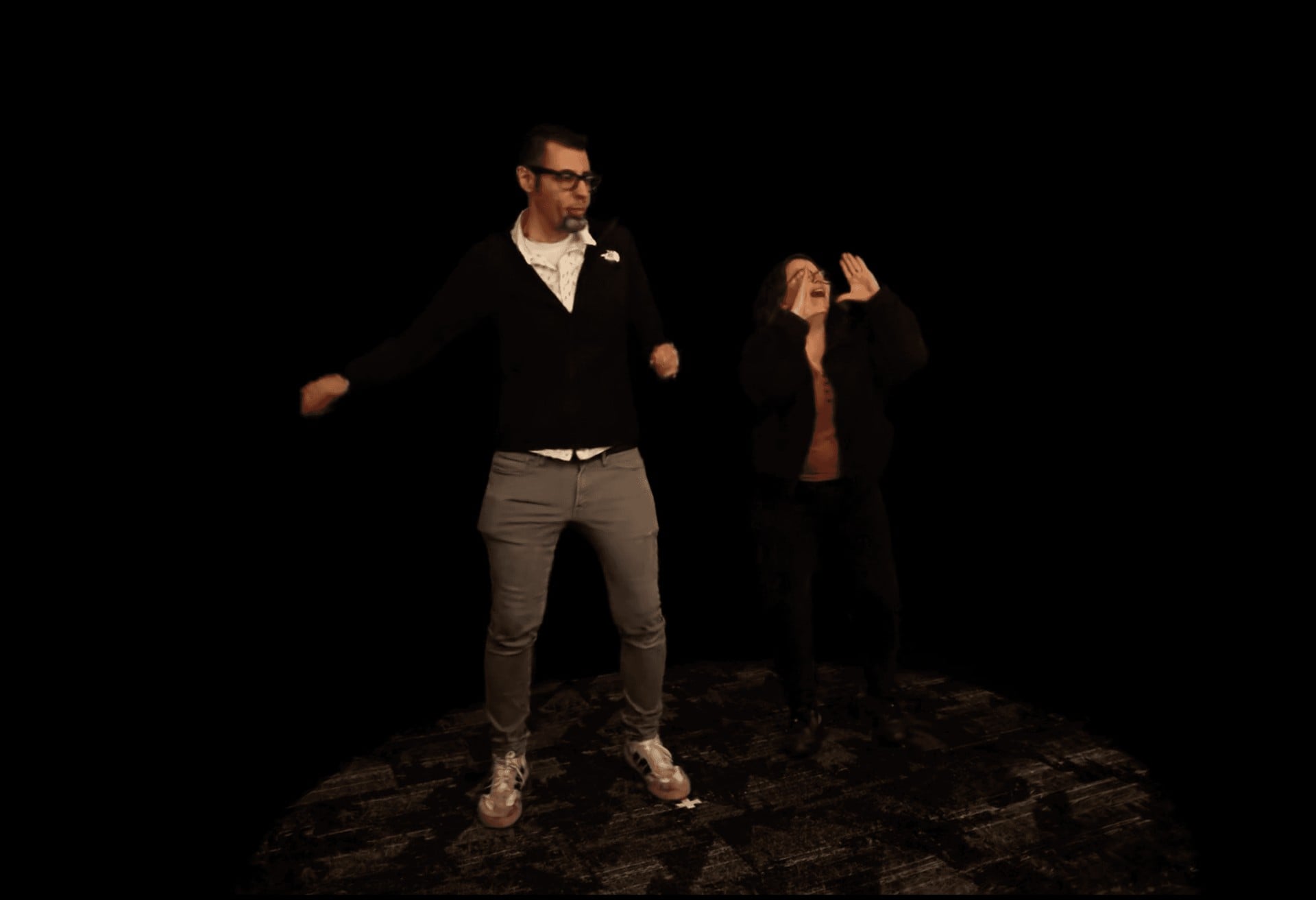
Arizona State University’s Narrative and Emerging Media program has released Open4DGS, an open-source pipeline that turns multi-camera footage from consumer cameras such as GoPros or Sony action cameras into 4D Gaussian splatting sequences. Instead of an expensive genlocked rig, a solver estimates each camera’s sub-frame timing offset and rolling shutter readout from epipolar flow between calibrated camera pairs, and falls back to timecode when its consistency checks fail, as Radiance Fields reports.

The seven-stage pipeline uses COLMAP for calibration, Background Matting V2 or SAM 2 for masks, RoMa v2 and MEMFOF for matching, and a training core based on TRiGS with a fixed primitive count, so GPU memory stays constant over long captures. Output is a .trigsbin timeline plus per-frame PLY files for Blender, Unreal Engine and WebGL viewers. The code is split into Open4DGS-Core and Open4DGS-Trigs under MIT and AGPL-3.0, written by Contrast Media Labs for the program. A Unity plugin and web SDKs based on Spark and three.js are on the roadmap.

XGRIDS puts the Lixel L3 on drones and cars, shipping in December

LinkedInHardwareIndustry

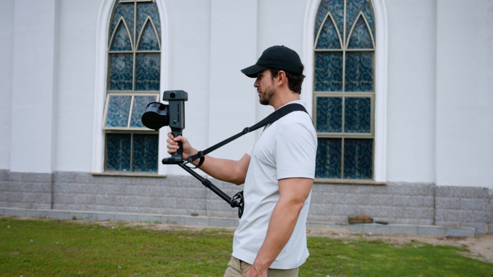
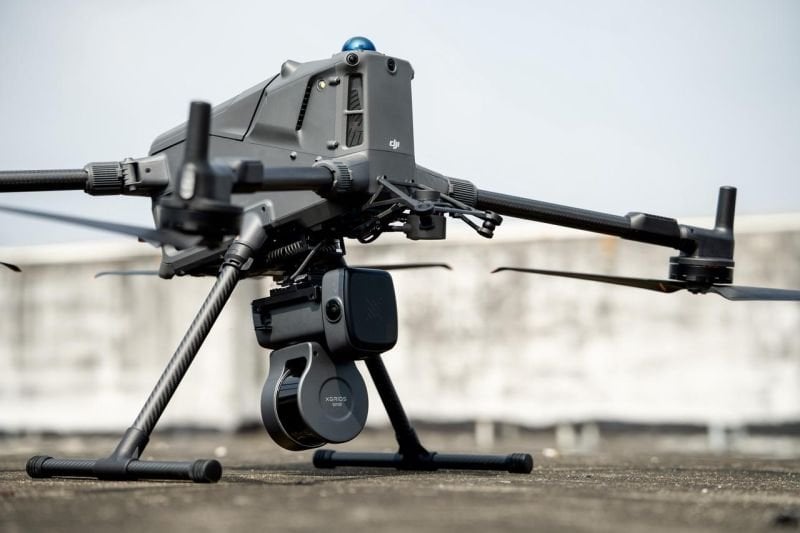
XGRIDS has announced dedicated drone and vehicle mounts for its Lixel L3 spatial scanner. In a LinkedIn post on 17 November 2026, also shared on X, the company says both setups let the scanner capture point clouds continuously while it moves, to cover large, complex sites and cut field time. Shipping begins in December through local XGRIDS distributors.

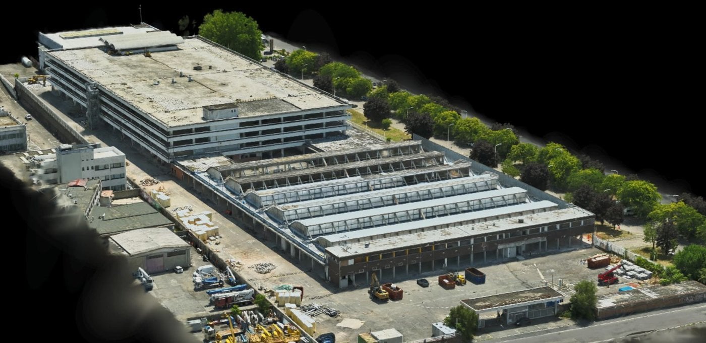
The drone-mounted solution is meant for aerial scanning of large sites, rooftops and building facades, with less risk for field crews. XGRIDS says the mounting angle is optimised for dense point clouds, the camera orientation for finely detailed colouring, and that scans are managed directly from the drone’s remote controller. The vehicle-mounted solution keeps point clouds uniform at 40 km/h, has an adjustable tilt for the scanner angle, and monitors the suction mount in real time while driving.

On its specification page, XGRIDS lists the L3 with 16 or 32 LiDAR channels, up to 640,000 points per second, a 0.7 to 120 m range, a forward camera and two panoramic cameras at 4096 × 3072, built-in survey-grade RTK and a 5 mm post-processed relative accuracy. Among the outputs are LCC (3DGS) single-scene reconstruction and 3DGS export as .lcc2, .lcc and .ply, next to point clouds, meshes, 3D Tiles and USD. XGRIDS says downloadable sample datasets and point cloud videos from both setups will follow, and that questions under the post will be answered in an upcoming FAQ. The LinkedIn post had 89 reactions when we picked it up.

XGRIDS brings a drone-mounted Lixel L3 to ElevateUAV 2026 in Miami

LinkedInEventsHardwareIndustry

XGRIDS will appear at ElevateUAV 2026 as a Bronze Sponsor, and says it is bringing a drone-mounted Lixel L3 reality capture setup to the show. The summit takes place on 17 and 18 November 2026 at Gulfstream Park in the Miami area. XGRIDS will be on the 3rd floor, in the Flamingo Room, at booth 18.

In a LinkedIn post, the company says the aerial setup is meant to cover large, complex sites faster and to reach places that are hard to access on foot. It will also show the Lixel K2 and the PortalCam, covering aerial and ground-based scanning for building and urban surveying, infrastructure, public safety and terrain mapping. Tickets are listed on the ElevateUAV site.

The Lixel L3 is XGRIDS’ flagship spatial scanner. The company says a single pass can produce a true-color point cloud, a mesh and a 3D Gaussian Splatting model, with a verified 5 mm relative accuracy. It combines LiDAR, a 1/1.3-inch CMOS 4K HDR camera, built-in RTK and a 4.3-inch display, so the scanner does not need a phone connection on site.

ON3D becomes XGRIDS partner for IsraelFeature

BlogIndustryHardware

ON3D, a division of Exodus HUB created as a result of the #100Splats campaign, is now listed on XGRIDS’ official international agent page as a partner for Israel. The company sells and supports the PortalCam spatial camera and LCC Studio software locally. The joined forces of the Nakash family and Josua Hönger open promising business opportunities and are a big gain for the Gaussian splatting community.

FreeGaussian now builds Gaussian splats from raw DJI Osmo 360 .OSV files

BlogCode & ToolsHardware

FreeGaussian says it now processes raw DJI Osmo 360 .OSV files natively, building a Gaussian splat and a 3D mesh from the camera’s original fisheye recordings rather than from a stitched export. The 11 November 2026 post puts the Osmo 360 on the same native fisheye pipeline the service already uses for the Insta360 X5 and X6 and the Antigravity A1.

Each .OSV keeps the two lenses as separate square fisheye videos, together with the motion data the camera always records. FreeGaussian reconstructs from those unstitched views and uses the IMU to recover gravity and scale, so floors come out level, walls vertical, and one metre in the scene matches one metre on site. In the company’s tests against measured markers, scale from 8K 30 fps video came within half a percent. It still advises checking a known distance in the viewer for survey-grade work. Because the output is metric, the viewer’s measuring tool reports metres directly, and the mesh can be dropped into Blender, a game engine, or a simulator such as MuJoCo or NVIDIA Isaac Sim without rescaling.

The pipeline is tuned on 8K video at 30 fps. Timelapse is discouraged, because it stores motion data too rarely and produces a scene that is level but not at real-world scale. Users should copy the original .OSV from the camera’s card and pick DJI Osmo 360 on the upload page; exports from DJI Mimo or DJI Studio, or any conversion that throws away the fisheye images and IMU data, lose those benefits. An exported equirectangular .mp4 can still be uploaded as equirectangular video. Raw .OSV files run about 1 GB per minute. The native pipeline is available on the free plan, with the usual terms: free uploads may be featured by FreeGaussian, while paid scenes stay with the customer.

GreenValley International names Land Axis Limited its official dealer in Kenya

LinkedInIndustryHardware

GreenValley International posted on 11 November that Land Axis Ltd has joined its partner network as official dealer in Kenya. The announcement describes a partnership to bring “advanced Spatial Intelligence solutions” to professionals in Kenya and the wider East African market, and to make a complete end-to-end LiDAR workflow more accessible to local customers, from data capture and processing to analysis and decision-making. The post itself does not mention Gaussian splatting.

Land Axis Limited’s public site, landaxisltd.com, lists the same contact number published in the announcement, +254 713 169 969, and describes the firm as a Kenyan land-surveying, geospatial and drone-technology company. GreenValley separately markets LiSplat for large-scale Gaussian scenes; that product is not named in the Kenya dealer post.

Manifold Tech will show its Odin Series at Swiss Robotics Day 2026

LinkedInEventsHardwareIndustry

Manifold Tech Limited posted on 12 November that it will exhibit its Odin Series Spatial Memory Modules at Swiss Robotics Day 2026 on 13 November, writing that the modules are meant to help robots perceive their surroundings, relocalize and navigate, and inviting developers to the booth. The company’s post lists the location as Lausanne, Switzerland, Booth 22.

The official Swiss Robotics Day 2026 site places the event at StageOne Event & Convention Center in Zurich on 13 November, and the exhibitor list names Manifold Tech at booth 23. We have not seen a correction from either side. Manifold’s Odin1 product page also lists MindCloud Render as Gaussian rendering software in the MindCloud suite; the LinkedIn post itself does not mention Gaussian splatting.

Flytech: the Italian engineers measuring the world from the air and now testing Gaussian splattingFeature

LinkedInIndustryHardware

Flytech is a young Italian engineering firm that turns drone, LiDAR and thermal data into certified, measurable results. Founded by civil engineer Davide Giovinazzo, it surveys sites to centimetre accuracy, inspects solar plants and is now testing DJI Terra's new Gaussian Splatting features.

XGRIDS publishes LCC2 captures from LCC Studio into District Cinema Terra

LinkedInIndustryHardware

XGRIDS posted that 3D Gaussian splat captures can be published from LCC Studio into District Cinema’s Terra platform, turning real-world locations into a 3D workplace for virtual scouting and production planning. LCC2 models can be published from LCC Studio to Terra in a few clicks. Once there, the post says teams can explore locations remotely, place 3D assets in their actual spatial context, and use real-world dimensions to plan camera setups, rigging, cable runs and equipment placement, with annotations and shared views for coordination across departments.

XGRIDS points to District Cinema Terra and its LCC Studio downloads for the two ends of that path. The company frames it as one capture serving both reality-capture and film-production workflows, from location scouting through technical planning.

UltraVoxelGS predicts ultrasound Gaussian scenes in seconds from posed slices

arXivPapersHardware

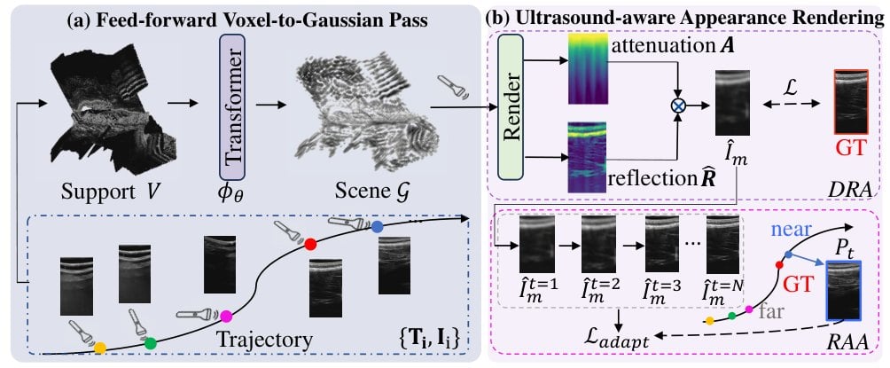
Yue Wang, Haoxin Chen and Xiaoqing Guo present UltraVoxelGS, a feed-forward 3D ultrasound reconstruction method that predicts a complete Gaussian scene from posed ultrasound images, avoiding per-scene optimization. Ultrasound slices share at most one-dimensional intersections and have view-dependent appearance from acoustic propagation, which breaks assumptions used by feed-forward Gaussian methods designed for natural images.

The system packs slices into a fixed-size voxel support and predicts Gaussian parameters directly, with an ultrasound-aware appearance model that factorizes reflection from cumulative attenuation. On real and simulated data, the authors report the best PSNR and SSIM among the compared per-scene baselines while cutting inference from 10–20 minutes to about 10 seconds, and they say it scales to sequences of more than 1,000 frames.

360 MCConverter V1.7.0 reads Metashape dense point clouds for 3DGS training

BlogCode & ToolsHardware

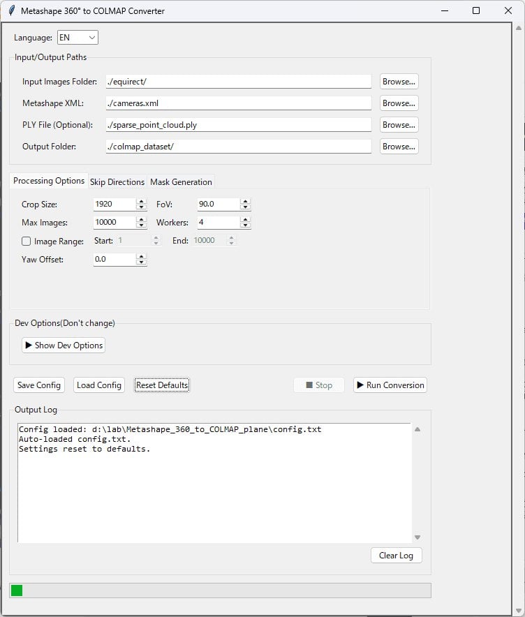
Radiance Fields reports that developer kotohibi has released 360 MCConverter V1.7.0, a paid Windows GUI that converts Agisoft Metashape 360° structure-from-motion results into COLMAP cubemap datasets for Gaussian splatting training. The new version can read Metashape’s dense point cloud, which is built from depth maps after alignment, rather than only the sparse tie-point cloud produced by camera alignment.

The V1.7.0 changelog, as quoted in the article, describes the dense-cloud path as intended “for more stable 3DGS training.” Earlier versions added direct loading of Metashape .psx projects, AprilTag scale written back into the project, and a Train Splitter for large scenes or limited VRAM. The multi-user license is listed at 12,500 JPY, perpetual, for any number of users in one organization, with commercial use permitted and redistribution prohibited; the app is sold on BOOTH.

PLS-GS builds a compact, surface-aligned Gaussian scene from camera and LiDAR

arXivPapersHardware

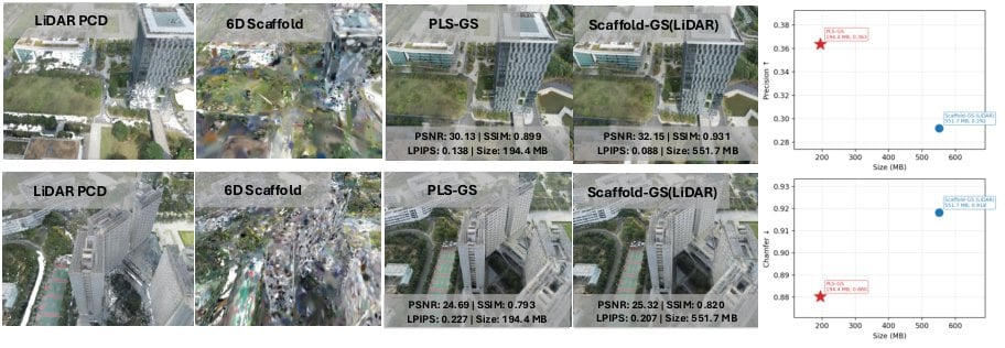
Krishnan Harikumar et al. introduce PLS-GS, accepted to WACV 2027, a probabilistic LiDAR scaffold for Gaussian Splatting when both camera images and high-definition LiDAR are available. A hierarchical Gaussian mixture is fitted jointly over position and color, giving a continuous adaptive scaffold that does not need voxel grids or octrees.

Each renderable 3DGS Gaussian is then tied to a mixture component and constrained in the local surface frame induced by that component’s covariance, with a Mahalanobis support loss limiting how far it may drift. The authors present this as a compact representation aligned to the measured surface.

Splat3D Swift SDK 1.1.0 records ARKit poses for hosted Gaussian reconstruction

BlogHardwareCode & Tools

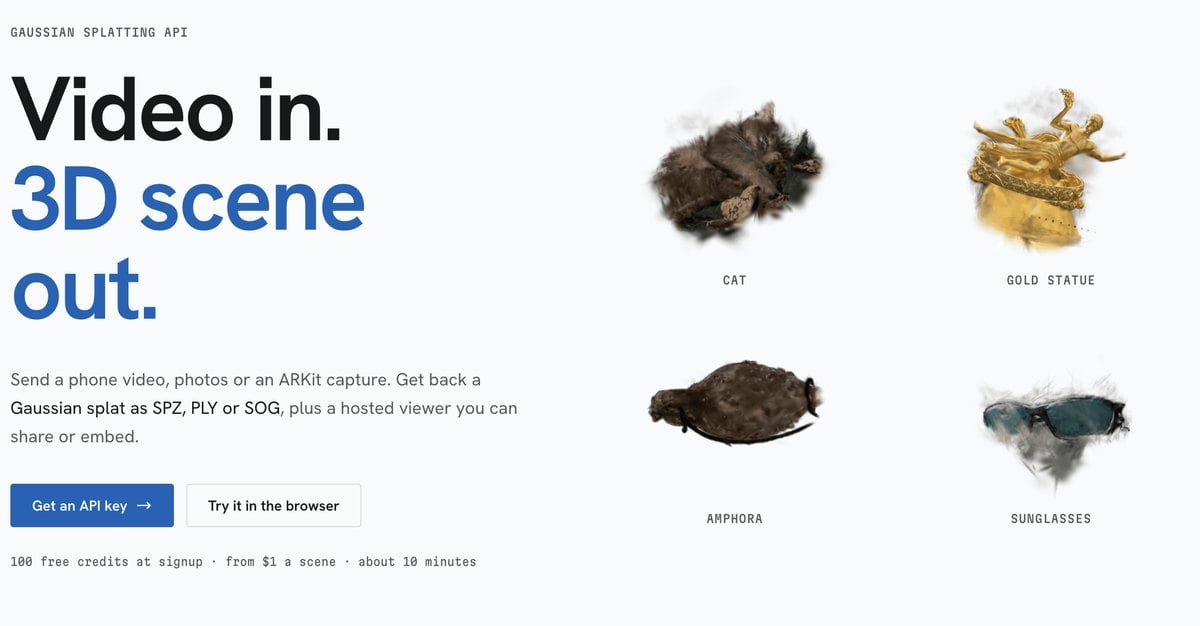
Radiance Fields reports that Splat3D has released Swift SDK 1.1.0, which records ARKit camera poses during an iPhone capture and sends them to Splat3D’s hosted Gaussian splatting API. The API accepts a phone video, a photo set or an ARKit capture and returns a splat as SPZ, PLY or SOG; reconstruction is described as running GLOMAP and gsplat on cloud GPUs.

Version 1.1.0, dated 4 November in the article, adds SplatScene.estimatedTimeRemaining from the API’s eta_seconds field. SplatScanner, which needs a physical iOS device, records H.264 video, samples poses at about 10 fps and can collect LiDAR points, using ARKit gravity for the scene up direction. The SDK requires iOS 16 or macOS 13 and Swift 5.10; Splat3D lists 100 free credits at signup and scenes “from $1.”

MosaicEarth Desktop adds local Gaussian reconstruction to a drone-mapping workspace

GitHubCode & ToolsHardware

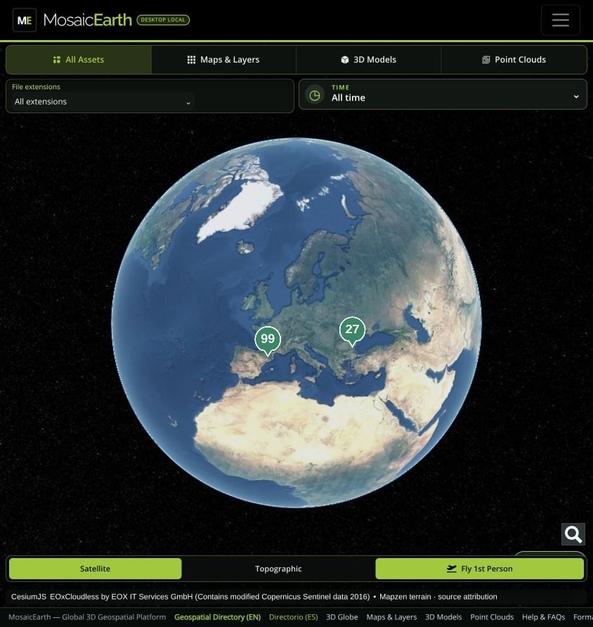
The nsicart/MosaicEarth-Desktop repository was created on 6 November 2026. The README describes a Windows and Linux application that runs the MosaicEarth web interface locally, keeping projects, original photographs and results on the user’s disk, with optional cloud sync.

Besides NodeODX/ODX photogrammetry for orthophotos, elevation models, point clouds and meshes, the desktop build can reconstruct Gaussian scenes from overlapping imagery with COLMAP and OpenSplat, then organize surveys in MyEarth and inspect georeferenced layers in MyMosaics, including a Fly View. GPU use is automatic when NVIDIA CUDA is available inside Docker, with a CPU fallback.

GSPIM accelerates 4D Gaussian splatting on PIM-enabled edge devices

arXivPapersHardware

Zirui Ma et al. present GSPIM, a temporal-locality-aware accelerator for 4D Gaussian Splatting on processing-in-memory edge devices, accepted to HPCA 2027. The authors argue that explicit 4D, keyframe and anchor-based methods waste memory bandwidth on inactive data and reload shared attributes across adjacent frames when working sets exceed on-chip cache.

Polymorphic PIM filters and packs valid data before transfer, multi-frame rendering reuses active attributes and depth relationships, and hybrid scheduling overlaps near-memory preparation with GPU rendering. Across three 4DGS methods and six dynamic scenes, they report a 4.15× geometric-mean speedup and a 4.99× energy-efficiency gain over an optimized frame-by-frame GPU baseline, with a maximum scene-level PSNR difference of 0.011 dB.

Hesai launches Kosmo, a lidar and 8K camera for Gaussian splat capture

BlogHardwareIndustry

Hesai has launched Kosmo, its first Gaussian splatting product, pairing the Kosmo One handheld capture device with the Kosmo World cloud platform that reconstructs captures as 3D Gaussian splats, meshes and depth. Kosmo One combines a Class 1, 1535 nm lidar rated at 569,000 points per second and 40 meters of range at 10 percent reflectivity with an 8K imaging system on a one-inch sensor and a high-precision IMU; Hesai claims millimeter-level geometric accuracy, says a typical 100 square meter room takes about 15 minutes to scan, and lists about 60 minutes of runtime from the standard battery.

Kosmo World produces aligned 3DGS, mesh and depth outputs from a single reconstruction and can fill missed areas with generative AI. Exports include .ply and .sog splats, .obj meshes, and .usd and .usdz scenes, with listed integrations for NVIDIA Isaac Sim, Isaac Lab, Unreal Engine, RenderMan and Houdini. Hesai has not published pricing or regional availability.