

GOFusion anchors Gaussians to occupancy submaps for real-time robot navigation
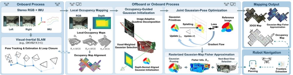
Boxin Bu, Simon Boche, Haoming Zhang and colleagues present GOFusion, a real-time visual mapping system that anchors Gaussian primitives to local occupancy maps so a robot has both spatial awareness for planning and high-fidelity appearance for information-driven navigation. 3D Gaussian maps are built from visual-inertial SLAM poses and local occupancy, optimization is restricted to active submaps to bound GPU memory, and a rasterizer-integrated Fisher approximation quantifies per-primitive sensitivity for pruning and next-best-view planning.
The authors report that GOFusion outperforms several baselines in mapping quality on public datasets and in real-world drone flights, and they demonstrate fully autonomous drone exploration for Gaussian map refinement using the Fisher-informed heuristic. Code is available on GitHub.